Wallberg /de
Deutsch Sprach-Codes: siehe Property:Has_Language SPRACHE
Contents
- 1 Fluggebiet
- 2 Umgebung
- 3 Veranstaltungen
- 4 Erfahrungs- und Reiseberichte
- 5 Revision
Fluggebiet
Startplatz
BILD
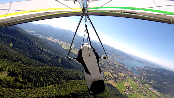
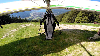
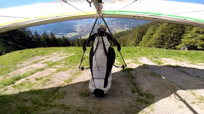
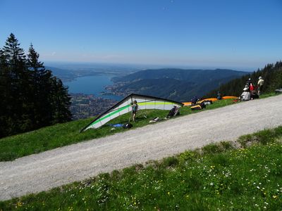
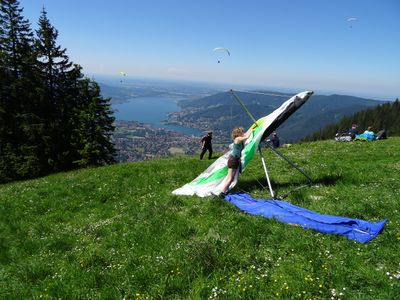
Startplatz Wallberg Nordwest
Koordinaten: 47° 39' 40", 11° 47' 26"
Startart: STARTART BEZEICHNER DEUTSCH"STARTART BEZEICHNER" is not in the list (Foot, Winch, Aerotow, Electric, Motor) of allowed values for the "Has Launch Technique" property.
Bezeichner: siehe Property:Has_Launch_Technique
Startrichtung: STARTRICHTUNG"STARTRICHTUNG" is not in the list (N, NNE, NE, ENE, E, ESE, SE, SSE, S, SSW, ...) of allowed values for the "Has Launch Direction" property., WEITERE STARTRICHTUNG"WEITERE STARTRICHTUNG" is not in the list (N, NNE, NE, ENE, E, ESE, SE, SSE, S, SSW, ...) of allowed values for the "Has Launch Direction" property.
Bezeichner: siehe Property:Has_Launch_Direction
Höhe: 0m
Höhendifferenz: 0m
Landeplatz
Landeplatz Wallberg HG
BILD
Koordinaten: 47° 40' 1", 11° 45' 16"
Höhe: 0m
Landeplatz Wallberg GS
Erreichbarkeit und Transport
Anfahrt
ANFAHRT
Auffahrt
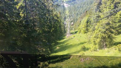
Zugänglich über: Bergbahn
Nur Kurzpack
Flug
Streckenflug
BESCHREIBUNG STRECKENFLUGMÖGLICHKEITEN
Bestimmungen und Gebühren
BESTIMMUNGEN UND GEBÜHREN
Besonderheiten
RECHTLICHES; SCHWIERIGKEITEN; WETTERBESONDERHEITEN; GEFAHREN
Weitere Informationen
Wetter
Jahresübersicht
| Frühjahr | Sommer | Herbst | Winter |
|---|---|---|---|
| Unbekannt | Unbekannt | Unbekannt | Unbekannt |
| BESCHREIBUNG BEDINGUNGEN IM FRÜHJAHR | BESCHREIBUNG BEDINGUNGEN IM SOMMER | BESCHREIBUNG BEDINGUNGEN IM HERBST | BESCHREIBUNG BEDINGUNGEN IM WINTER |
Bezeichner für Bedingungen: siehe Property:Has_Spring_cond
EVENTUELL LINK ZU WETTERSEITE
Webcam
Videos
Weitere Beschreibungen
LINKS ZU ANDEREN GELÄNDEBESCHREIBUNGEN
Flugschulen und Clubs
Treffpunkt
Alternative Gebiete
Automatisch erstelle Liste von Gebieten im Umkreis von 50km:
Blomberg /de, Brauneck /de, Greiling /de, Gschoellkopf /de, Hahnenkamm /de, Hochries /de, Hollersbach /de, Koessen /de, Vogelsang Bayrischzell /de, Wallberg /de, Wank /de
EVENTUELL WEITERE TIPPS ZU ALTERNATIVEN FLUGGEBIETEN IN DER NÄHE
Umgebung
Kontinent: BEZEICHNER in Continent, Land: BEZEICHNER in State, Region: BEZEICHNER in Region, Provinz: BEZEICHNER in Province, Gemeinde: BEZEICHNER in Municipality
Ortschaften
ORTSCHAFT IN DER NÄHE
Unterkunft
TIPPS UNTERKUNFT (CAMPINGPLATZ/ HOTEL)
Gastronomie
TIPPS GASTRONOMIE
Sehenswertes und Aktivitäten
SEHENSWERTES IN DER UMGEBUNG; ALTERNATIVE IDEEN FÜR SCHLECHTES WETTER UND FÜR NICHTFLIEGER
Veranstaltungen
01.01.2000
Erfahrungs- und Reiseberichte
LINKS ZU REISEBERICHTEN MIT KURZBESCHREIBUNG(REISEBERICHTE IN EIGENEM NAMESPACE REPORT:)
Revision
Status: Benötigt Überarbeitung? BEZEICHNER Needs Revision state"BEZEICHNER Needs Revision state" is not in the list (None, Low, Mid, High) of allowed values for the "Needs Revision state" property.
Bezeichner: siehe Property:Needs_Revision_state
Status: Benötigt Medien? BEZEICHNER Needs Media state"BEZEICHNER Needs Media state" is not in the list (Picture, Video, Webcam, Weather) of allowed values for the "Needs Media state" property.
Bezeichner: siehe Property:Needs_Media_state
Bearbeiter:
The page NAME DES FLUGGEBIETS does not exist.
Longitude: 11.754338888889 +
Longitude: 11.790641666667 +
