Tribalj /de
Deutsch
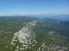
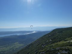
Tribalj is one of the most famous places for paraglider flying in Croatia, and probably has the biggest number of flights during whole year. It is well known among foreign pilots who were here and for sure they rember it as realy cool place to enjoy fling.
Flüge in diesem Gelände müssen vorher angemeldet werden. Vor dem Flug ist die Meldung, Einweisung und Bestätigung beim Geländehalter einzuholen:
Scheinbar gibt es hier eine Neuerung? Please use de QRcode on the takeoff to register before flying. There is FREE WIFI on the takeoff!
Contents
- 1 Fluggebiet
- 2 Umgebung
- 3 Veranstaltungen
- 4 Erfahrungs- und Reiseberichte
- 5 Revision
Fluggebiet
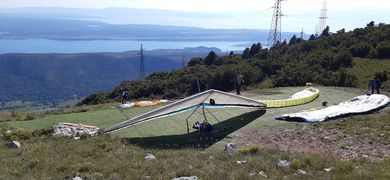
Startplatz
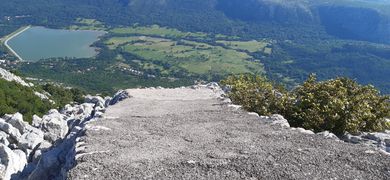
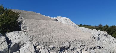
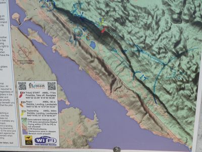
Startplatz Rampe
Koordinaten: 45° 14' 46", 14° 40' 13"
Startart: Hang
Startrichtung: S, SSW, SW
Höhe: 730m
Höhendifferenz: 664m
Mit Steinen befestigte und aufgeschüttete Rampe
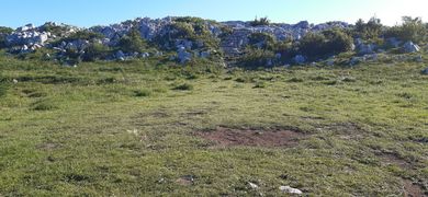
Startplatz Natur
Koordinaten: 45° 14' 23", 14° 40' 59"
Startart: Hang
Startrichtung: S, SSW, SW
Höhe: 773m
Höhendifferenz: 707m
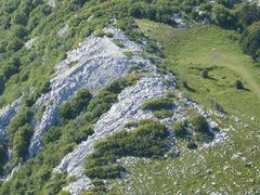
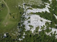
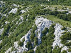
Starting elevation is 770 meters, and altitude difference to the landing is about 680 m. The start is the covered with small stones and sand. On clean plateau 3 wings can spread but around can be much more gliders. T Take off is for the southeast, south, southwest and west wind, and you can take off on the thermal (due channeling) even with the eastern wind. Main characteristic is thar take off is in the saddle so that air flows channeled. When stronger wind blows mixed with thermals take off can be demanding, especially for beginners. In summer it is possible to take off from early morning till evening, while flying to untiltill the sunset.
O, SO, S, SW, W
Landeplatz
Koordinaten: [[Has L coordinates::45°13'58.14"N,14°39'35.63"E]
Höhe: 66m
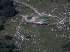
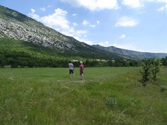
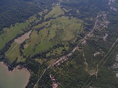
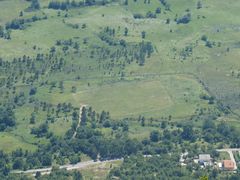
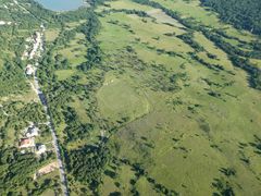
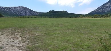
Landings: big fields in the valley
Top Landing: big fields 500m from the takeoff to the W
Erreichbarkeit und Transport
Anfahrt
ANFAHRT
Auffahrt
Zugänglich über: Straße
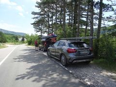
Asphalt road goes all the way to the take off. Usually there are other pilots from local club. Your arrival must be announced to local operator.
Flug
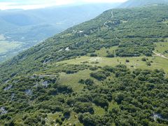
Tribalj is not the place for making big 100 km XC flights but more for relaxed ridge and thermal flying along 20 km long ridge with height going from 300-800 m above sea level. As you are flying very close to the sea and the landing is at 50 m ASL pilot has very beautiful view on the Kvarner bay, coast and the island in front. Four sure it would be possible to jump to other island in front.
Even though that flying place is close to the sea, we never have strong sea breeze so we are enjoying all our flights in thermals. Maximum heights are in July but it can be any time of the year and go up to 3200 m ASL. Off course those days are rare and usually the ceiling is at 1500-1700m ASL.
Because of the light sea breeze we have lot of flyable days during whole year and even some nice days in winter time. It is not problem to make 3 hour flight on a nice day in winter time.
For beginners Tribalj is best in the afternoon when the thermals become soft and wide in combination with laminar wind from the south directions. For those who want more Tribalj in the noon can make thermals up to 8m/s so you can have nice and fast XC flight.
More experienced pilots will fly away from the ridge to the inland making some straight or flights with return. Usually best is to catch convergence earlier in the day and then fly with it to inland.
Best flights in Tribalj are up to 80km, but basically it is place for fun flying. Flights can be found on XCGlobe.
Streckenflug
Bestimmungen und Gebühren
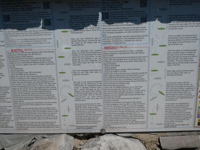
Flüge in diesem Gelände müssen vorher angemeldet werden. Vor dem Flug ist die Meldung, Einweisung und Bestätigung beim Geländehalter einzuholen: => Über einen QR Code, ganz einfach, Erklärung folgt
Takeoff operators are: Marko Hrgetiæ +385 95 8143976, hrga@pjkflumen.org or Vedran Mihaljevic +385 98 260 431.
Dieser stellt eine Euch eine Bestätigung über die Einweisung aus. Ohne Einweisung darf nicht geflogen werden! Flüge ohne Bestätigung werden bestraft! Ein Versicherungsschutz gegenüber Schäden Dritter ist Pflicht! Kommerzielle Tandemflüge sind nur mit Erlaubnis des örtlichen Clubs möglich.
Third party insurance is mandatory. Comercial tandem flights are forbidden without permision of local club.
Besonderheiten
Nicht bei Bora! Dann evtl. nach Lijak ausweichen.
Weitere Informationen
Wetter
Jahresübersicht
| Frühjahr | Sommer | Herbst | Winter |
|---|---|---|---|
| Unbekannt | Unbekannt | Unbekannt | Unbekannt |
| BESCHREIBUNG BEDINGUNGEN IM FRÜHJAHR | BESCHREIBUNG BEDINGUNGEN IM SOMMER | BESCHREIBUNG BEDINGUNGEN IM HERBST | BESCHREIBUNG BEDINGUNGEN IM WINTER |
EVENTUELL LINK ZU WETTERSEITE
Webcam
Videos
- [https://www.youtube.com/watch?v=6r7fEsGMh0g ]
- [https://www.youtube.com/watch?v=AabHjOMklfw]
- [https://www.youtube.com/watch?v=0iJggMU7qnA]
- [https://www.youtube.com/watch?v=V09kpkd6zEs]
- [https://www.youtube.com/watch?v=ELZZmC4oO3s]
Weitere Beschreibungen
[Tribalj in der DHV Geländedatenbank]
Flugschulen und Clubs
Startplatz kontakt Marko Hrgetic Hrga (club president) Parajedrilicarski klub Flumen http://www.pjkflumen.org mob: +385(0)958143976 info@pjkflumen.org hrga@pjkflumen.org
http://www.paraglidingcroatia.com/ http://www.paraglidingcroatia.com/en/paragliding-croatia/tribalj-vinodol.html
Treffpunkt
Alternative Gebiete
Automatisch erstelle Liste von Gebieten im Umkreis von 50km:
Hohe Munde /de, Nebelhorn /de, Roiano Campli /de, Seefeld /de, Test
Umgebung
Kontinent: Europe, Land: Croatia, Region: BEZEICHNER in Region, Provinz: BEZEICHNER in Province, Gemeinde: Tribaljy
Ortschaften
Tribalj
Unterkunft
TIPPS UNTERKUNFT (CAMPINGPLATZ/ HOTEL)
Gastronomie
Sehenswertes und Aktivitäten
Veranstaltungen
01.01.2000
Erfahrungs- und Reiseberichte
Revision
Status: Benötigt Überarbeitung? BEZEICHNER Needs Revision state"BEZEICHNER Needs Revision state" is not in the list (None, Low, Mid, High) of allowed values for the "Needs Revision state" property.
Status: Benötigt Medien? BEZEICHNER Needs Media state"BEZEICHNER Needs Media state" is not in the list (Picture, Video, Webcam, Weather) of allowed values for the "Needs Media state" property.
Bearbeiter: Vilenya

