Treskavec /de
<ref></ref>
Deutsch SPRACHE
PrilepPrelip
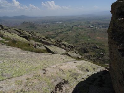
https://xcmag.com/travel-guide/macedonia-magic-prelip/: Treskavec and the nearby site of Selechka sit on the hills on the opposite side of the Pelaginian Plain from KruŠevo.
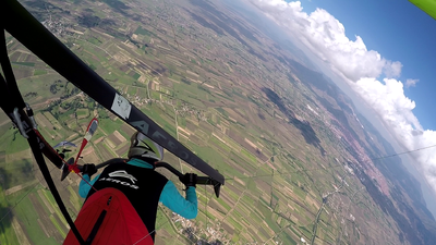
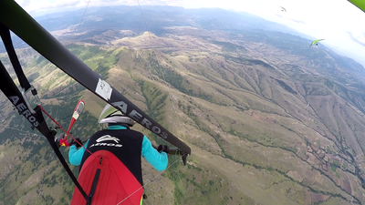
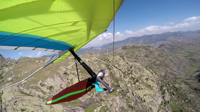
Like that site they give access to both mountain and flatland flying and are a great alternative when it’s over the back at KruŠevo.
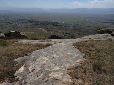
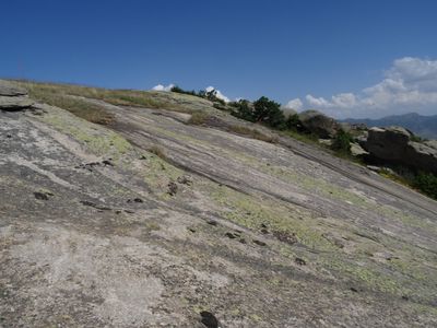
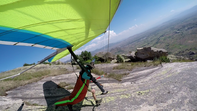
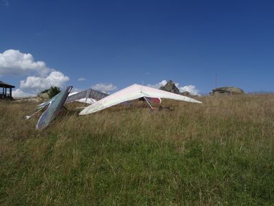
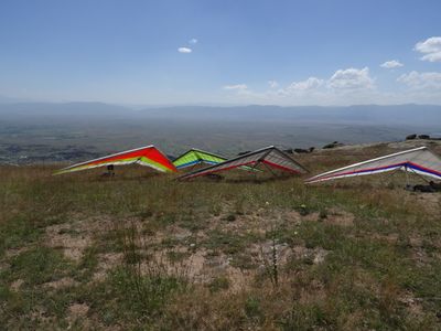
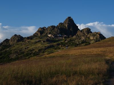
A new road goes up to the Monastery of Treskavec (12th century, well worth a visit). The launch is on the grassy slopes just below the monastery where you will find info boards and a weather station. The hill is covered in huge granite boulders, and the distinctive triangular peak behind the monastery, known locally as the Matterhorn, is the route to base.
XC flights can go along the hills to the north or south passing over the town of Prelip and onto the hills around Selechka, from where the route heads south to the Greek border.
Contents
- 1 Fluggebiet
- 2 Umgebung
- 3 Veranstaltungen
- 4 Erfahrungs- und Reiseberichte
- 5 Revision
Fluggebiet
Startplatz
Koordinaten: 41° 23' 53", 21° 31' 54"
Startart: Hang
Startrichtung:
Höhe: 1170m?
Höhendifferenz: 470m?
per Auto, zu Fuß
viel Aufbauplatz
Start für Drachen über die Felsen vorne, wie Rampe
GS starten darüber auf der Wiese
Landeplatz Drachen
Koordinaten: 41° 22' 56", 21° 30' 57"
Höhe: 704m?
Landeplatz Aerodrome
Koordinaten: 41° 20' 16", 21° 26' 59"
Höhe: m
Wenn man aufdrehen kann, kann man ganz bequem am großen Aerodrome mitten im Tal landen.
Landeplatz Gleitschirm
Koordinaten: 41° 23' 51", 21° 30' 33"
Höhe: 770m?
Erreichbarkeit und Transport
Anfahrt
Auffahrt
Zugänglich über: Straße
Geteert bis fast zum Schluss, letzte Meter guter Feldweg Platz um Auto stehen zu lassen
Flug
Streckenflug
- http://www.dhv-xc.de/leonardo/index.php?op=show_flight&flightID=1255042
- http://www.dhv-xc.de/leonardo/index.php?op=show_flight&flightID=1014223
Bestimmungen und Gebühren
Besonderheiten
Weitere Informationen
Wetter
Jahresübersicht
| Frühjahr | Sommer | Herbst | Winter |
|---|---|---|---|
| Unbekannt | Unbekannt | Unbekannt | Unbekannt |
| BESCHREIBUNG BEDINGUNGEN IM FRÜHJAHR | BESCHREIBUNG BEDINGUNGEN IM SOMMER | BESCHREIBUNG BEDINGUNGEN IM HERBST | BESCHREIBUNG BEDINGUNGEN IM WINTER |
Webcam
Videos
Weitere Beschreibungen
Flugschulen und Clubs
Treffpunkt
Alternative Gebiete
Automatisch erstelle Liste von Gebieten im Umkreis von 50km:
Krushevo /de, Novoselani /de, Novoselani2 /de, Sliva /de, Treskavec /de
Umgebung
Kontinent: Europe, Land: North Macedonia, Region: BEZEICHNER in Region, Provinz: BEZEICHNER in Province, Gemeinde: BEZEICHNER in Municipality
Ortschaften
Zlatovrv, Prilep
Unterkunft
Gastronomie
Sehenswertes und Aktivitäten
Veranstaltungen
01.01.2000
Erfahrungs- und Reiseberichte
Revision
Status: Benötigt Überarbeitung? BEZEICHNER Needs Revision state"BEZEICHNER Needs Revision state" is not in the list (None, Low, Mid, High) of allowed values for the "Needs Revision state" property.
Status: Benötigt Medien? BEZEICHNER Needs Media state"BEZEICHNER Needs Media state" is not in the list (Picture, Video, Webcam, Weather) of allowed values for the "Needs Media state" property.
Bearbeiter: Vilenya
