Krushevo /de
Deutsch SPRACHE
Krushevo
HG und GS
Thermik und Strecke in Bergen und Flachland. Mehrmaliges FAI1 Wettbewerbsgebiet für Drachen.
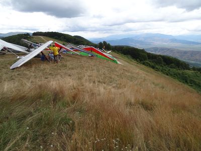
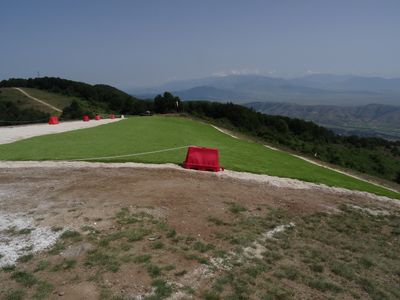
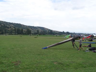
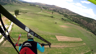
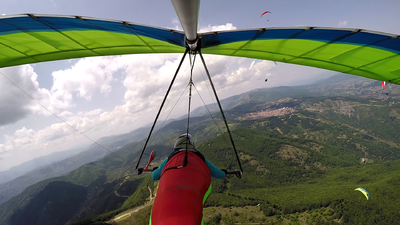
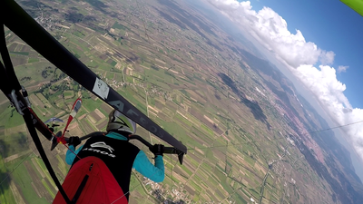
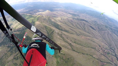
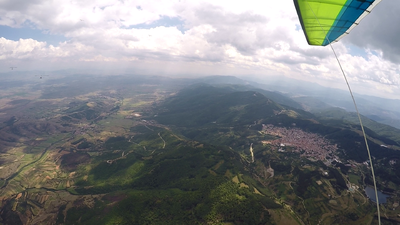
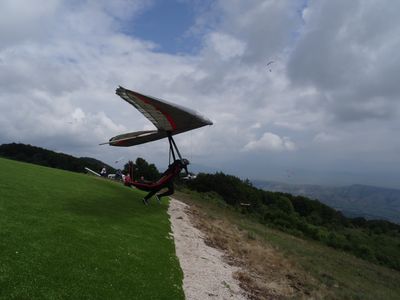
The take off site is just 5 minutes drive from the town Krusevo, and is accessed by a tarmac road, and has lots of parking space. At a height of 1400 ASL ,the grassy take off slope, looking over the Pelagonian valley.Take off faces East and so the flying day starts early.The valley floor itself is 600 metres ASL and is encircled by mountains. There is therefore lots of opportunity for closed circle tasks and triangular tasks and the thermals function very well in the valley after midday. Landing is never a problem with large, unfenced and often empty fields everywhere and very friendly local farmers! The valley also has a good network of roads and that makes retrieval easy .
Contents
- 1 Fluggebiet
- 2 Umgebung
- 3 Veranstaltungen
- 4 Erfahrungs- und Reiseberichte
- 5 Revision
Fluggebiet
Startplatz
Krushevo Ost
Startart: Hang
Startrichtung: SW
Höhe: 1412m
Höhendifferenz: 805m
per Auto, zu Fuß
Flacher Naturstart, teilweise mit Matten ausgelegt. Sehr viel Aufbauplatz.
http://pgworlds2019.mk/site/: It is facing east – northeast towards Pelagonia Valley. It is several minutes drive from the town and an asphalt road goes almost through the launch. When you take the paraglider out from the car, it is already on the place where it should be open. Lazy pilots will love this launch. East Start is a grassy shallow slope bordered by big trees from the South, which offers thick shadows in sunny days. Home thermals are everywhere: on the left, on the right side from the take off and sometimes straight ahead. All kind of different cross-country flights can be made from East start. Usual flights are out-and-return to town Prilep to the East, all kind of triangles and zigzags in the valley or over the ridge or distance flights to the South up to the Greek border. Coming back from the South is quite difficult because in “normal” summer afternoon light north wind is blowing through the valley. A good road connection helps coming back.
Krushevo Südwest
Koordinaten: 41° 20' 24", 21° 15' 21"
Startart: Hang
Startrichtung: SW
Höhe: 1443m
Höhendifferenz: 805m
per Auto, zu Fuß
Flacher Naturstart
http://pgworlds2019.mk/site/: It’s a secondary smaller take off place facing west – southwest, it is 500 meters away from East Start. Cars, again, can be driven right up to the launch. The same cross-country flights can be done from here. Landing fields under this launch are smaller than on the other side of mountain where there are very large fields, mostly grassy. This launch can also be used for beginners so landings should suit competition pilots too!
Landeplätze
Landeplatz Ost
Koordinaten: 41° 21' 25", 21° 17' 41" Große Wiese, in OStrichtung leicht abschüssig. Meist Nullwind. An dem Fabrikgebäude und den nördlich davon hohen Bäumen erkennbar.
Höhe: 638m?
Landeplatz Aerodrome
Koordinaten: 41° 20' 16", 21° 26' 58" Höhe: 638m
Notlandeplatz Ost?
Anschauen/abklären! Koordinaten: 41° 20' 58", 21° 18' 16"
Höhe: 638m
Landeplatz West
Koordinaten: 41° 18' 36", 21° 13' 26"
Höhe: 638m
Enge Wiese in Nord-Süd Ausrichtung. Von Bäumen umgeben. Südwind. In der Mitte großer Fels mit Windfähnchen. Nicht ganz einfach, aber mit guter Einteilung machbar.
Erreichbarkeit und Transport
Anfahrt
ANFAHRT
Auffahrt
Zugänglich über: Straße Geteerte Straße bis zum Start
Flug
Berge und Flachland https://xcmag.com/travel-guide/guide-to-krusevo-macedonia/: FLYING CONDITIONS The best conditions are from June to September. In the begining of the year there is more moisture and more clouds, but as the year progresses it becomes drier with fewer clouds. Conditions don’t generally change very quickly and it is very predictable, making the flying safe. There are no strong valley winds in the area. Average cloudbase: 2,500-3,000m
Keine Lufträume?
Startzeit gegen 1200, Thermik dann vom Oststart an der Kuppe/Kante Nordöstlich vom Start
Streckenflug
https://xcmag.com/travel-guide/guide-to-krusevo-macedonia/: With its mix of flatland and mountain terrain Kruševo is a great venue for flying cross country. The area is suitable for all levels of pilot, with wooded hills on the on the west side of the valley creating conditions that aren’t too strong, and rocky ridges on the east side create booming thermals for the experienced XC hounds. The flying arena is a natural bowl, making it great for triangles.
From launch, pilots can easily follow the ridge north or south. Going north you can follow the hills round to the east side of the plains and the town of Prilep, where conditions are often stronger amongst the rocky mountains in this area. There are two launches on this side, accessed by tarmac roads.
For the more adventurous it is possible to leave the immediate area and fly north back towards Skopje. Macedonia is a country of mountains so there are plenty of possible routes.
Viele Landemöglichkeiten im Flachland
Bestimmungen und Gebühren
Besonderheiten
Weitere Informationen
Wetter
Am besten April-November
Jahresübersicht
| Frühjahr | Sommer | Herbst | Winter |
|---|---|---|---|
| Unbekannt | Unbekannt | Unbekannt | Unbekannt |
| BESCHREIBUNG BEDINGUNGEN IM FRÜHJAHR | BESCHREIBUNG BEDINGUNGEN IM SOMMER | BESCHREIBUNG BEDINGUNGEN IM HERBST | BESCHREIBUNG BEDINGUNGEN IM WINTER |
- Holfuy Station: https://holfuy.com/en/data/147
Webcam
Videos
- Best moments of the FAI Hang Gliding Chps 2016 in Krushevo: https://www.youtube.com/watch?v=kfclzNFNAi8
Weitere Beschreibungen
- https://www.dhv.de/db2/details.php?qi=glp_details&popup=1&item=3481
- https://xcmag.com/travel-guide/guide-to-krusevo-macedonia/
- http://www.paragliding-macedonia.com/
- http://pgworlds2019.mk/site/
- https://krusevopen.wixsite.com/xscfly/flying_sites
- https://www.balcanicaucaso.org/eng/Areas/North-Macedonia/Krusevo-s-paragliding-wonderland-180180
Flugschulen und Clubs
Treffpunkt
Alternative Gebiete
Automatisch erstelle Liste von Gebieten im Umkreis von 50km:
Galicica /de, Krushevo /de, Novoselani /de, Novoselani2 /de, Sliva /de, Treskavec /de
Umgebung
Kontinent: Europe, Land: North Macedonia, Region: BEZEICHNER in Region, Provinz: BEZEICHNER in Province, Gemeinde: BEZEICHNER in Municipality
Ortschaften
Krushevo
Unterkunft
Gastronomie
Sehenswertes und Aktivitäten
Kruševo was the first republic in the Balkans, and was the site of a major battle between the Turks and the Macedonians. There area has plenty to go and see on rainy days: there are several museums, the Ilinden monument, several monastries and the ruins of the Roman town of Heraclea Lyncestis in the town of Bitola are not far away. In the mountains there are good mountain biking trails and Prilep has become known as one of the best bouldering areas in the world.
Veranstaltungen
- https://www.fai.org/news/23d-fai-world-hang-gliding-class-1-championship-2021-will-be-held-krushevo
- https://www.fai.org/civl-krushevo2018
01.01.2000
Erfahrungs- und Reiseberichte
Revision
Status: Benötigt Überarbeitung? BEZEICHNER Needs Revision state"BEZEICHNER Needs Revision state" is not in the list (None, Low, Mid, High) of allowed values for the "Needs Revision state" property.
Status: Benötigt Medien? BEZEICHNER Needs Media state"BEZEICHNER Needs Media state" is not in the list (Picture, Video, Webcam, Weather) of allowed values for the "Needs Media state" property.
Bearbeiter: Vilenya
Longitude: 21.29475 +, 41° 20' 16", 21° 26' 58"Latitude: 41.337694444444
Longitude: 21.449555555556 +, 41° 20' 58", 21° 18' 16"Latitude: 41.349388888889
Longitude: 21.304472222222 + and 41° 18' 36", 21° 13' 26"Latitude: 41.310083333333
Longitude: 21.224 +
