Grobnik /de
Deutsch
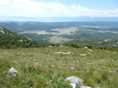
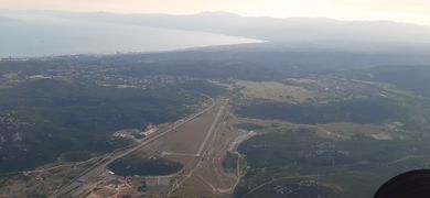
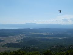
Grobničko polje is situated in near town Rijeka and it si connected with highway Rijeka-Zagreb. It is favourite flying place of local pilots due to good road connectivity and skill needed for flying there. There is no ridge so thermal flying must be skilled. Terrain is flyiable whole year but best thermals are in early spring when there is still snow in the mountains but the fiels in front are clear.
Contents
- 1 Fluggebiet
- 2 Umgebung
- 3 Veranstaltungen
- 4 Erfahrungs- und Reiseberichte
- 5 Revision
Fluggebiet
Startplätze
Zbelac
Koordinaten:45° 23' 54", 14° 32' 43"
Startart: Fuß
Startrichtung: SE, SSE, S, SSW, SW, W, NW
Höhe: ca. 845m 818 laut Fluggebieteverzeichnis
Höhendifferenz: ca. 550m?
Hangstart, Naturstart, etwas unebene Wiese
Für Wind eher aus West Für Wind Aus Südwest laut Fluggebiete
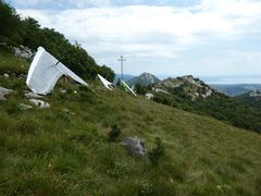
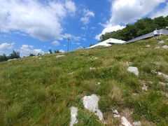
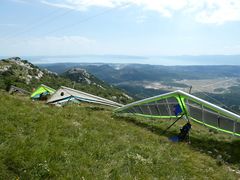
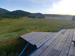
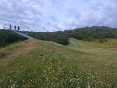
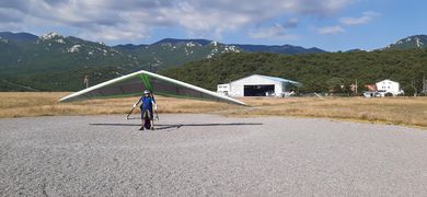
Žbelac has altitude 845m ASL. Start is short with few obsticles, take off not for begginers. Best is to wait thermal and then you are up in one second. Take off is big enough for parallee take off of four gliders. From main road it is 10 minutes on foot.
Mrtvak
Koordinaten:45° 23' 59", 14° 33' 5"
Startart: Fuß
Startrichtung: SE, SSE, S, SSW, SW
Höhe: ca. 913m
Höhendifferenz: ca. 610m
Hangstart,
Für Wind eher aus Süd
Laut Fluggebiete rein West!
Mrtvak (big take off START 2) is higher take off 908m ASL. Take off is long enough and oriented from SE to SW. At good day you can climb instantly but the main thermal activity is in forn lower take off. For westerly winds it is best to use lower take of and for more south wind, higher takeoff.
Übungshang
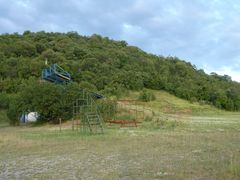
Übungshang der HG Flugschule KSL Krila Kvarnera
Landeplatz
Koordinaten: 45° 22' 42", 14° 30' 47"
Höhe: 303m
Neben dem Gebäude landen Landing is at 310 m ASL
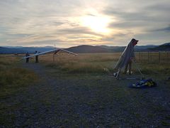
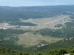
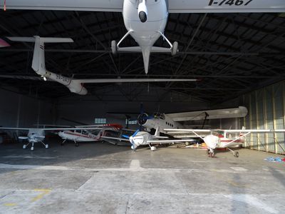
It is forrbiden to enter at airfields landing zone below 600 m ASL. At landing you go over small hill Turčin ( behind hangars) . For landing use zone marked at pictures. DO NOT LAND IN MILITARY COMPLEX BELOW TAKEOFF ŽBELAC! It is shooting range!
Erreichbarkeit und Transport
Anfahrt
Rijeka
Auffahrt
Zugänglich über: Straße
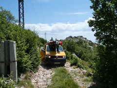
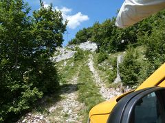
Grobničko polje has threee take offs: Žbelac, Mrtvak i Hahlić. Žbelac & Jazvina are situated NE from sport airfield and are offten used. Coming to take off is by road to sky resort Platak. On one curve is cross road and there you leave your car on macadam road. Macadam road on the left goes to Jazvina and right one for Mrtvak.
Flug
BESCHREIBUNG FLUGBEDINGUNGEN IM GLEITWINKELBEREICH
Streckenflug
BESCHREIBUNG STRECKENFLUGMÖGLICHKEITEN
Bestimmungen und Gebühren
Airfield is main landing so it is important to first contact operator: +385 (0) 51 250 114 (airfield) +385 (0) 98 720 170 ( Mr. Miljenko)
Besonderheiten
RECHTLICHES; SCHWIERIGKEITEN; WETTERBESONDERHEITEN; GEFAHREN
Weitere Informationen
KSL Krila Kvarnera https://www.facebook.com/krila.kvarnera.ksl/
Wetter
Jahresübersicht
| Frühjahr | Sommer | Herbst | Winter |
|---|---|---|---|
| Unbekannt | Unbekannt | Unbekannt | Unbekannt |
| BESCHREIBUNG BEDINGUNGEN IM FRÜHJAHR | BESCHREIBUNG BEDINGUNGEN IM SOMMER | BESCHREIBUNG BEDINGUNGEN IM HERBST | BESCHREIBUNG BEDINGUNGEN IM WINTER |
Webcam
Videos
- [https://www.youtube.com/watch?v=HbnrJNzY8kQ] (Starts am Startplatz Grobnik)
- [https://www.youtube.com/watch?v=dJzv7FveD1I]
- [https://www.youtube.com/watch?v=INI6Sb-BfQY]
Weitere Beschreibungen
Flugschulen und Clubs
Paragliding club Flumen: Tel.: +385 958143976 ENG,SLO,CZ,SVK,HR; mailto:info@pjkflumen.org; URL: www.pjkflumen.org
Treffpunkt
Alternative Gebiete
Automatisch erstelle Liste von Gebieten im Umkreis von 50km:
Baska /de, Brest /de, Brgud /de, Grobnik /de, Lico Polje /de, Pecnik /de, Raspadalica /de, Ucka /de
Umgebung
Kontinent: Europe, Land: Croatia, Region: BEZEICHNER in Region, Provinz: BEZEICHNER in Province, Gemeinde: BEZEICHNER in Municipality
Ortschaften
Rijeka
Unterkunft
Gastronomie
Sehenswertes und Aktivitäten
Veranstaltungen
01.01.2000
Erfahrungs- und Reiseberichte
Revision
Status: Benötigt Überarbeitung? -"-" is not in the list (None, Low, Mid, High) of allowed values for the "Needs Revision state" property.
Status: Benötigt Medien? -"-" is not in the list (Picture, Video, Webcam, Weather) of allowed values for the "Needs Media state" property.
Bearbeiter: Vilenya

